The Clyde River on the NSW South Coast is one of the state's important oyster-producing estuaries, accounting for around 11 per cent of NSW oyster production at the time of the project. Flooding, falling salinity and extreme heat can affect oyster health, harvesting and farm operations within hours. Working with NSW Department of Primary Industries and Regional Development, Eurobodalla Shire Council and local growers, Meshed helped provide the LoRaWAN connectivity and digital infrastructure to monitor these conditions in real time.
The Challenge of a Fast-Changing Estuary
Oyster farmers operate in a dynamic environment where changes in rainfall, salinity, water temperature and extreme heat can directly affect oyster health, harvesting decisions and productivity. Flooding can rapidly reduce salinity and affect water quality, while extreme heat can threaten oyster survival.
Traditionally, farmers had limited access to real-time, highly localised environmental information on which to base operational decisions. The project needed reliable communications capable of connecting sensors positioned throughout a challenging estuarine environment where conventional cellular connectivity could not be relied upon.
Connecting Sensors Across the Clyde River
As part of its Smart Cities Initiative, Eurobodalla Shire Council had established a LoRaWAN network in consultation with Meshed, including a gateway on the Mt Wandera radio tower, approximately 20 kilometres from the Clyde River. This long-range, low-power infrastructure provided a practical way to connect sensors across a geographically challenging estuary.
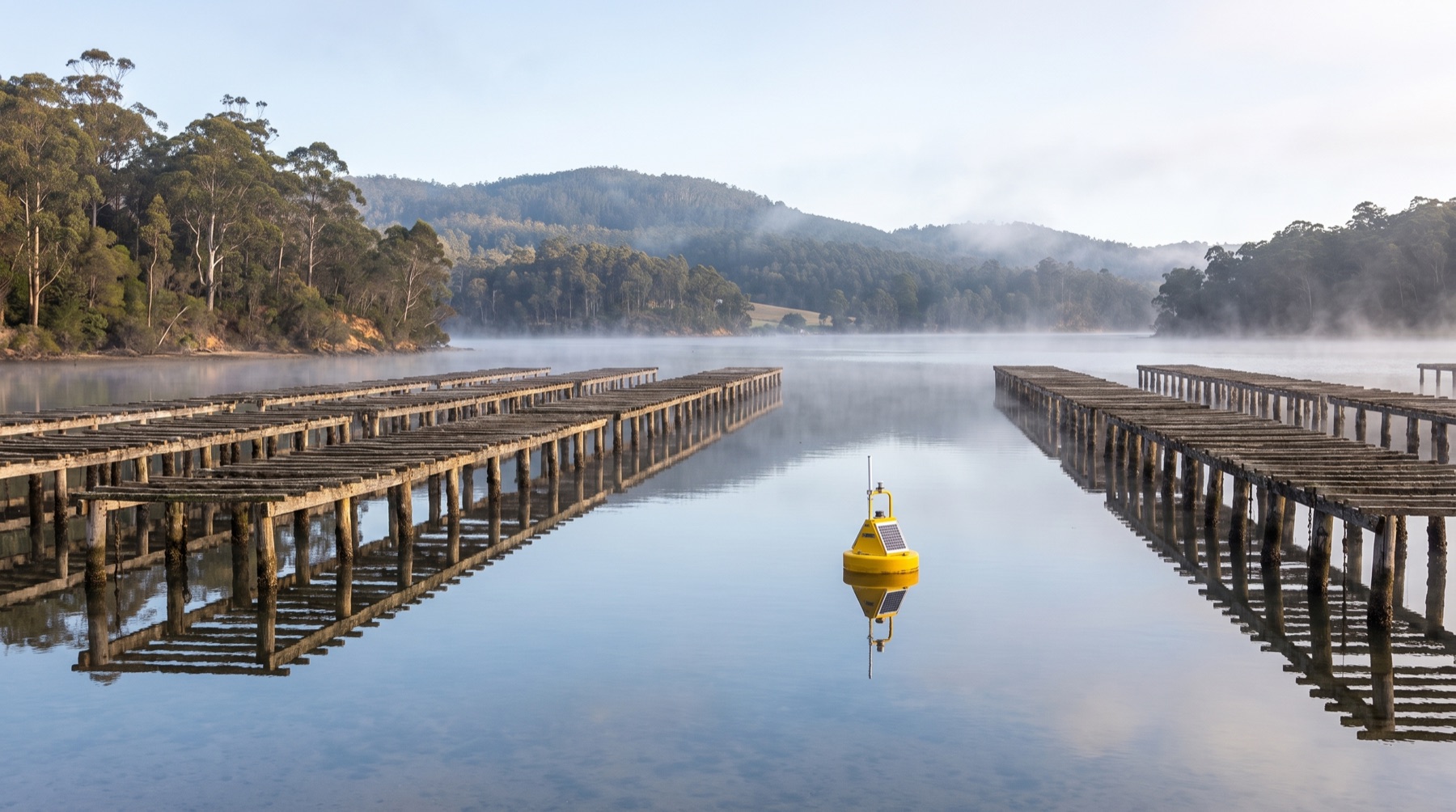
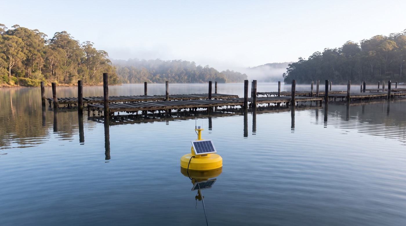
Ten buoys equipped with submerged water-quality sensors were distributed across approximately eight kilometres of the estuary, complemented by a local LoRaWAN-enabled automatic weather station. Each buoy carried a LoRaWAN sensor node connected to temperature and salinity probes positioned about 40 centimetres below the surface, the zone relevant to oyster production, with solar panels supporting remote operation in a demanding marine environment.
From Sensor Data to Farmer Insight
Data collected on the river were transmitted wirelessly from the buoys via LoRaWAN to the gateway and on to digital platforms. Meshed provided the Meshed Asset Intelligence Platform for managing and visualising the sensor information, while project data were also delivered into NSW DPI's FarmDecisionTECH platform.
FarmDecisionTECH turned the environmental data into graphical visualisations accessible on desktop and mobile, with about 60 per cent of users on a phone. Farmers could create custom alerts when temperature or salinity crossed a nominated threshold, so they could check conditions while working on the river rather than waiting for manual sampling or a return to a desktop.
Real-Time Monitoring in Extreme Events
The value of the network became clear during extreme events. During summer monitoring, the local weather station recorded maximum temperatures at Batemans Bay approximately 5 degrees Celsius higher than those reported at Moruya Airport, the existing source of live weather for growers, showing why locally captured, real-time information matters.
The Outcome for the Oyster Industry
For the oyster industry this has direct operational significance. Harvesting areas are subject to salinity and water-quality criteria, and extreme temperatures can require immediate intervention to protect stock. Real-time monitoring supports better-informed decisions around harvesting, stock management and responses to flooding and heat events.
During one three-month summer period, the Clyde River FarmDecisionTECH dashboard recorded 378 unique page views despite only around 17 growers on the river, a strong signal of industry engagement. The result shows how shared LoRaWAN infrastructure can extend beyond smart-city applications into regional industries, environmental monitoring and climate resilience.
This deployment is documented in peer-reviewed research.
Real-time water quality monitoring of the Clyde River oyster estuary using LoRaWAN and IoT, Sensors, MDPI, 2021.
The estuary, visible in real time. On the water, on a phone, before conditions turn.